
We and other Loopers were made wonderfully welcome at the bar and in the restaurant of IVY Club in Peoria. This is just the way the yacht club reciprocal arrangement is supposed to work. Members stopped by and asked about our travels, and shared some of their own boating experiences. In the past we have found that this level of friendliness and welcome is sadly lacking at most other yacht clubs we have visited, so it was a nice change.
The next morning, we were up early and moved to the fuel dock to be ready at opening for a pump out. It was an easy run to the only lock of the day. The lock was ready for us, but we were happy to wait for two other Loopers who we knew were a little behind us. The rest of the day was surprisingly boring. After all the interesting sights and wildlife further north, there was little to see.
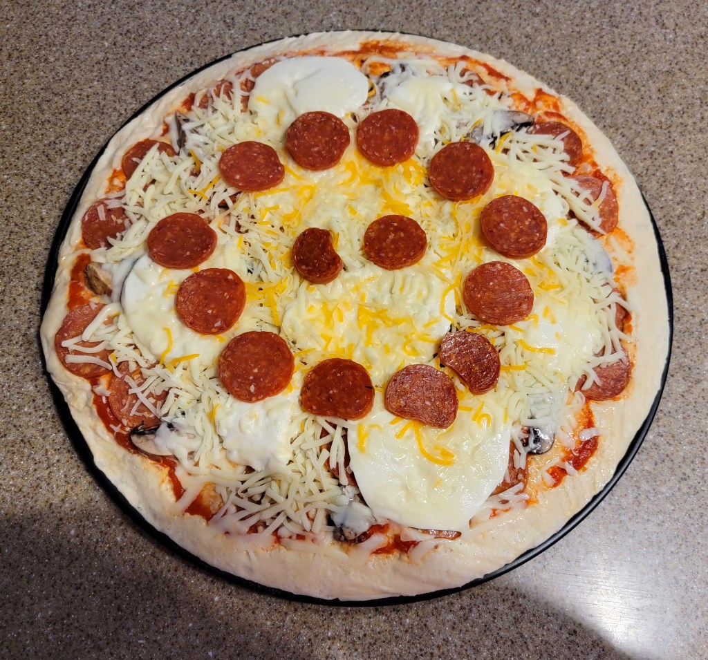
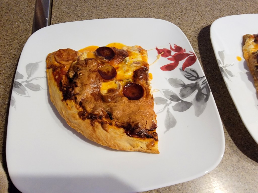
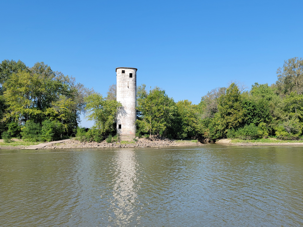
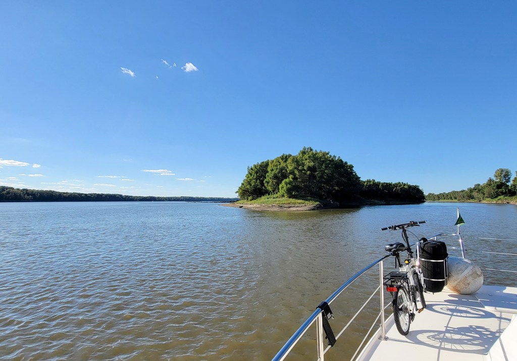
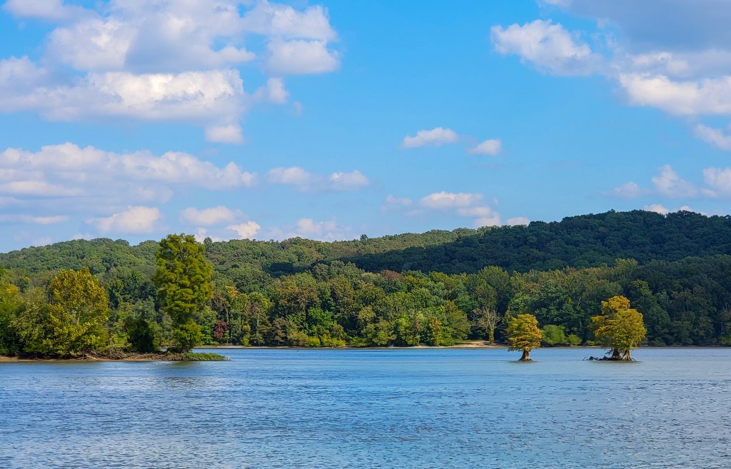
We anchored behind Quiver Island, along with 6 other Looper boats. It’s an obvious stopping place, especially as the water is very low this year, and many docks at marinas are inaccessible. For dinner I tried a modified recipe for pizza dough, that was much more successful than the previous effort. It also was helpful that I found the proper pizza pans!

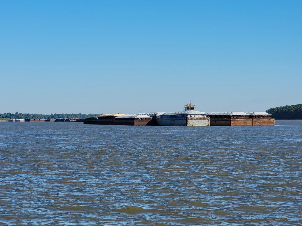
On Friday morning we left the anchorage a little later than we had planned, especially with a long 60-mile passage ahead. Again, it was mostly uninteresting scenery, with a few highlights to relieve the tedium. We met a 15-barge string on a bend. The big tows like this take up the whole river when they negotiate a corner, so we were glad to be able to talk to the tow and arrange safe passing. A little later, from around another bend and only a few feet above the water came a bright yellow airplane. It rose a little to pass over us, and then dipped again and continued to follow the river northward.
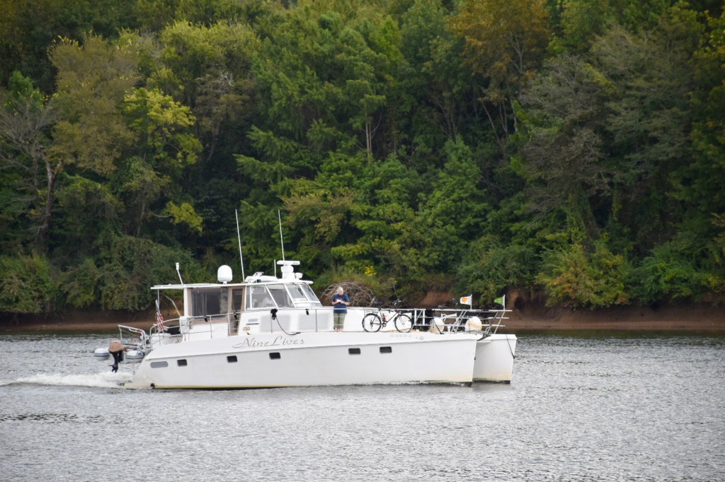
Eventually we arrived at LaGrange lock, shortly after noon. We were advised by the lockmaster that as soon as the tow ahead of us was finished he would refill the lock and put us through. We floated quietly in the channel, as we had done at every other lock, nudging with the engines to keep position. There was no other boat traffic above or below the lock. Unexpectedly, the lockmaster came on the radio and told us we could not wait in the channel, and we should move over to near the bank and anchor. The reviews on Active Captain and Waterway Guide indicated that this was a bad place to anchor, with poor holding, but we did as we were told. It took a couple of tries before the anchor held. Just 15 minutes later, we could see that the tow had cleared the lock, so we called and asked if it would be our turn. The lockmaster told us to pull our anchor “now”. Well, we tried. It absolutely would not come up. Dick made many attempts, and the bow of the boat dipped alarmingly as the chain tightened. The Illinois River has a strong current, and due to our width, and proximity to the bank, as well as the current, we were unable to bring Nine Lives around to be above the anchor and try to pull it out that way. We called for help from TowBoatUS. They had to come more than 60 miles, and could not get to us in daylight, so we stayed where we were overnight. No worries about the anchor dragging anyway!
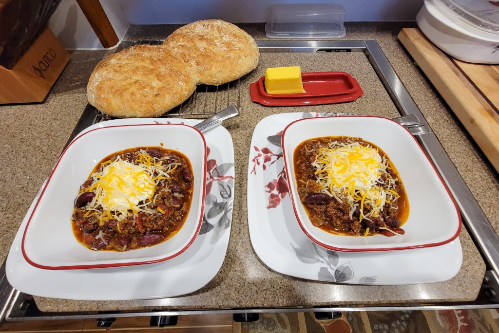
I made a new recipe for chili for our dinner, very tasty, definitely a keeper, although Dick commented that he might prefer it on a cold winter evening instead of in 80-degree heat! The next morning there was plenty of time for one of Dick’s famous bacon and egg breakfasts. TowBoatUS arrived shortly after 10am. The first attempt to free us appeared successful, until we tried again to raise the anchor and it was clear that all that had happened was the rescue boat had dragged us and the tree along the bottom! (We are presuming it was a really large sunken log that we were caught on). The rescue boat then took all of our anchor chain onto their boat. This involved cutting what is known as the bitter end, the line that connects the very end of the chain to the boat. Nine Lives then moved out of the way, and the rescue boat was able to maneuver with their powerful engines and work the anchor free of whatever it was that had caught it. We were very glad that the last resort, cutting the chain and abandoning the anchor on the bottom of the river, was not required. To remind us just how lucky we were, on the day I am writing this, there is a posting from another AGLCA member who had a similar experience, catching a large submerged log at an anchorage. TowBoatUS was too far away to travel to help them, and they were forced to cut their anchor chain and leave a very good, expensive anchor on the bottom.

Next, we had to wait for the lock. Although TowBoatUS has priority as a commercial vessel, there was a split tow already negotiating the lock. When a string of barges is too large to fit into the lock all at once, the string has to be split, and locked through in parts. This takes a very long time, as the tow has to maneuver to and fro, the barges have to be uncoupled and recoupled, and the lock has to be emptied and filled several times. After about a 2 hour wait, we could see that the tow was finished. Dick overheard a conversation between the lockmaster and the tow operator, that suggested that there were no tows waiting for locking, “just a pleasure boat”. That would be us. We watched for another hour while nothing happened. We are quite sure that the lockmaster and the tow were enjoying a leisurely lunch together while we waited.
Finally through the lock, after more than 24 hours, we ran fast to try to catch up some of the lost time, slowing occasionally to pass villages, and tows with their barges. We were undaunted, and got right back on the horse and anchored behind an island off the river that night. Is that the right metaphor? Back on the horse? Hmmm. Anyway, we were fine, very tired after a stressful day, and we slept well. In the morning the anchor came up without problems, although we noticed a certain amount of strain on the electric winch. We decided that the lesson to be learned from our experience is to anchor well away from shore when in a river, as the debris on the bottom gets washed to the sides of the channel.
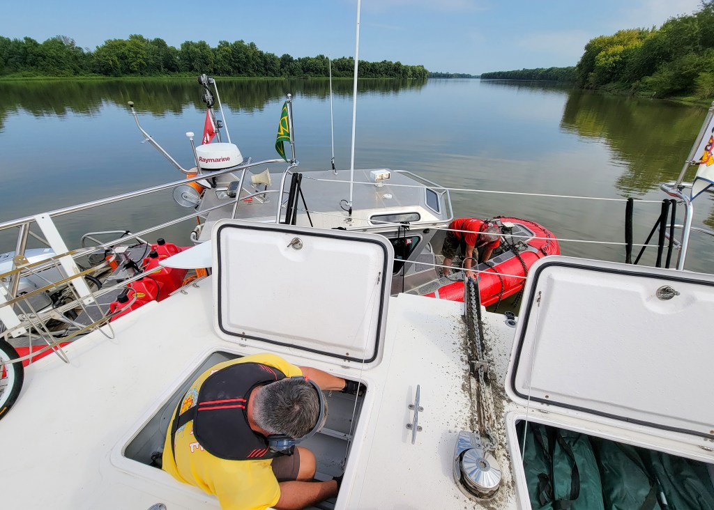
So how do we anchor? Once we are roughly in position, I take over from Dick at the helm, and after donning life vest, gloves, and headset, Dick goes up to the bow and lowers the anchor using the electric winch. We have marked the chain at 20-foot intervals, so he knows just how much rode (chain) goes out. Once the anchor is on the bottom, we allow the wind and current, with a little help on my part from the engines, to gently move us back, first until we feel the anchor take hold, and then further as more rode is paid out. After a ratio of 7 to 1 is achieved (that is, if the bottom is 10 feet down from the bow, there must be 70 feet of chain), the bridle is attached. This is two lines, one from each pontoon bow, clipped to the anchor chain. More rode is then paid out. This means that any strain caused by wind or wakes is taken by the bridle lines rather than the winch. In the morning, the whole process is reversed, and I am always glad to hear Dick tell me, “the anchor is up” as it comes off the bottom!

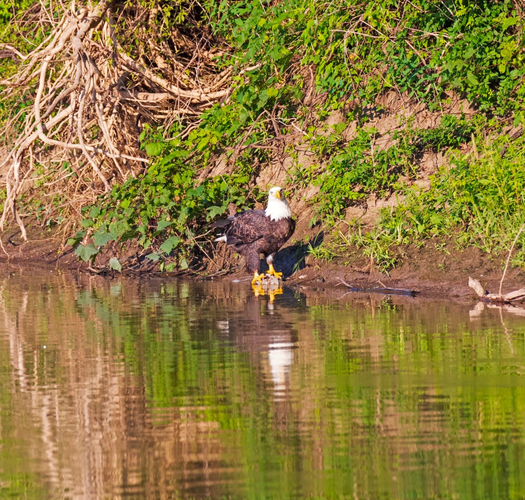
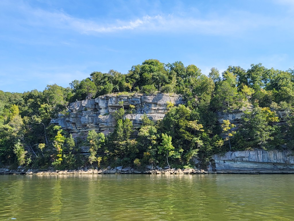
A few low hills varied the scenery the next day. We saw lots of bald eagles, showing that the river is a clean environment in spite of the amount of industry and commercial traffic. We also started to see kudzu.
Kudzu is a highly invasive plant that has been dubbed “the vine that ate the South.” It was imported to the USA in 1876 as an ornamental garden plant, and was used for erosion control in the 1930’s to 1950’s. The vine grows up to a foot a day. It is gradually spreading northwards, and has been found in Oregon, and in Southern Ontario. Kudzu smothers everything in its path. It spreads by runners that root where they touch the soil, by rhizomes underground, and by new vines that root at the nodes and form new plants. It destroys native grasses and plants, and even mature trees, as it covers them and prevents the leaves from photosynthesis. Despite its negative environmental impact, kudzu does have some uses. It is used as animal feed, the fibres are used in basketry, it can be used to make clothing and paper, and it is an ingredient in food and folk medicine in Asia.

We found the tows we met were universally helpful. The procedure when one meets a tow is to call, and depending on whether you are meeting to pass, or wish to overtake, you explain your intentions and ask where they want you. They will tell you, “on the one” or “on the two”. This is quite confusing at first! “On the one” means that you will meet or pass with the tow on your port side. “On the two”, is starboard. You need to remember that it is your port or starboard, not that of the tow!
We arrived in Grafton shortly after noon. Note to selves, not a good stopping place on the weekend! The marina was chaotic, reminding us of Henry’s Fish Camp in Georgian Bay. Mostly little boats arrive and depart, and a lot of smaller slips are kept available for them. The very popular Grafton Oyster Bar is located in the marina, and many boaters arrive for lunch and dinner. At one point I overheard the dockhand telling another to “help this pontoon boat, he says it is the first time he has ever driven a boat!” Well, conditions were not good for a complete beginner, it was windy and choppy, and the space in the marina is tight. In spite of my warning to Dick to see if he could fend them off, the neophyte boater managed to add another scrape to Nine Lives hull.
Another interesting few moments occurred when a very large houseboat arrived in the marina. They did not use their radio. The dockhand called out to them that there wasn’t room for them, and I could clearly hear a man on the boat call out to the driver, “just keep going!” They swung into the open space at the end of the dock we were on, a space that was clearly reserved for another boat. There were at least 15 people on board, and the men were aggressive and (I later learned) quite drunk. One can hardly blame the teenage dockhands for not wishing to challenge them. Unfortunately, the Loopers whose spot they had taken arrived long before the entitled idiots departed, and had to spend the night on the fuel dock. We were not surprised when they chose to leave the next day rather than taking up their second night’s reservation.
We will return to Grafton Marina I am sure, but not on a weekend! The food at the Oyster Bar was excellent.
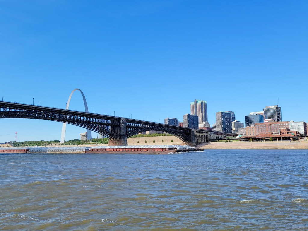
We had a very short run to Alton, a suburb of St Louis on the Mississippi River. No restaurants nearby were open that night so we ate on board. We were now in delivery mode, travelling as quickly as possible to our final destination this summer. We expect to travel these rivers several times in the next few years as we complete our various summer voyages, so there is less incentive to stop at this time. Unfortunately, the weather was filthy, with rain and fog all day, so we stayed an extra day at Alton. Docktails was arranged for Loopers in the evening. It was the largest group we have participated in for some years! We agreed on a spokesman for the boats leaving the next day who would negotiate with the lock for all of us.
The extra day did allow for an excellent meal at a nearby fine dining restaurant.
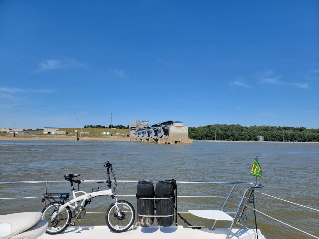
The next morning 10 Looper boats plus one TowBoatUS rescue boat transited Mel Price lock together by 7:30am. It was a very early start, with engines running at 6:15am! It really does make a difference when we travel as a group through the commercial locks. There were no delays at the second lock of the day, and we were all through by 9:30am, unprecedented!
Dick read that 30% of the world’s grain passes through Mel Price lock, which gives you an idea of just how busy the Mississippi River is.
It was a very long run that day. While St Louis was interesting, this part of the Mississippi is very industrial. We passed many tows, the last one pushing 24 barges. We also had a chance to look at a popular Looper stop. Hoppies is the only fuel stop for many miles on this stretch of the waterway. It is not a real dock, instead it is several barges that boats tie up to, then later arrivals must raft up. Although it is part of Looper legend, we are thinking that we may well give Hoppies a miss when we pass through in future. We tied up at that night at another popular Looper stop, on the wall below Kaskaskia Lock, a short detour up the Kaskaskia River. There were 5 boats that night, so there was room for all and nobody had to raft up.


The next day was a 100-mile run with a 7am start, but regardless, we were anchored by 4pm, thanks to a 4-knot current in our favour and a stretch where we ran fast. Now that we were on the Mississippi (Huckleberry Finn country), the accents of the tow operators became increasingly impenetrable. It was quite amusing to listen to them on the radio when they were talking to each other, clearly a lot of important information was passed along, and we couldn’t understand a word of it, between the strong accents and the jargon. Fortunately, they were easy enough for us to understand when we hailed them to ask for passing instructions.
We stopped at a good anchorage just north of the town of Cairo, where the Ohio River joins the Mississippi. Unfortunately, while Boston Bar is well off the river, it is under a highway bridge, so quite noisy. Two other Looper boats joined us. This was our last anchorage of the season, and while the anchor came up cleanly, the winch was really struggling, so we will need to get it looked at. We suspect it was overstressed when we were stuck at La Grange lock.
Once again Nine Lives was covered in mayflies. It was a surprise to see them, so I looked it up and discovered that mayflies are not just for May, they hatch right through September! We were also troubled for the first time by small biting gnats, and even larger biting flies.


The next day we turned up the Ohio River. We went from travelling with help from a 4-knot current on the Mississippi, to fighting against at least 3 knots resistance. Some of the time on the Ohio we were making as little as 4.6 knots against the current (our normal speed is about 8 knots). There were a large number of anchored barges, but fortunately not many underway, possibly due to construction operations at Olmstead Lock.
We arrived at Olmstead Lock at 11:30, and had to wait for the day’s blasting program to finish. We had to anchor in 25 feet of water against a 3-knot current, not ideal. We could have been held up as late as 2pm, but fortunately we were allowed to proceed at noon. The water on the Ohio was so high that the lock was not operating. Instead, we passed right over the dam, against a strong current that increased to 4.5 knots over the wickets. It was a strange experience.
We were at Paducah town dock by 3:30, but the free dock was already very busy, so we had to stay on the fuel dock the first night. It is a rather stinky location, because that corner of the basin traps a lot of dead fish and algae, and the power pedestal is too far away for our cords to reach, so we cannot run the air conditioners without the generator.
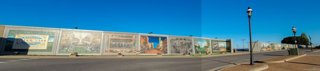
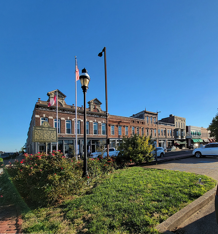
Paducah was definitely the most interesting town on this part of our journey. The town was laid out by William Clark (remember Lewis and Clark from your American history classes) in 1827. It is believed he named the town Paducah after the Comanche people of the Western plains, who were known as the Padoucas by regional settlers. The town became an important port on the river system, as well as being a railroad hub. It is clear from the beautiful old houses and downtown buildings that there was once a great deal of wealth in the town. The area has been prone to flooding, with a flood in 1937 that rose to more than 60 feet. The earthen levee that should have protected the town was overwhelmed, so a substantial concrete flood wall was built. Part of this wall has been painted with over 50 murals depicting the history of the town and the area.


We enjoyed a wonderful dinner that first evening at Cynthia’s, excellent fine dining. The town looked fascinating as we walked to the restaurant. After several very long travel days I was glad to have a quiet day while Dick explored the town. He returned in time to help 6 Looper boats tie up. We made plans to head out to dinner an hour early, so I would have time for a few pictures. As Dick set the ladder into the slots at the side of the boat for me to get off, a big Sabre came round the point and waked all the boats so badly that our ladder fell into the water (it was 10 feet deep under the boat, and in spite of fishing with our longest boathook, there was no chance of retrieval). The owner of the Sabre happened to be coming into the dock for fuel and an overnight stop. He was very sorry, and said he would replace the ladder, even offered to build something temporary. When we returned from dinner there was a step ladder on our deck, kindly left for us by a fellow Looper, but unfortunately it was not useable. Dick was able to pull the stern of the boat in closely enough to the dock for me to get on.
Our dinner that second evening was interesting. Clearly a talented chef, but much better quality control was needed. The steaks were tasty, but neither the asparagus nor the potatoes should ever have left the kitchen.

In the morning Dick was able to find and order a replacement ladder. He showed the receipt to the owner of the Sabre, who immediately handed over the full cost in cash. Interestingly, while the owner was full of apologies, his adult son, travelling with him, had nothing to say and scowled the whole time. If we were to make a guess, we think it was in fact the son driving, and he didn’t see anything wrong with his speed and was annoyed with his father who likely told him off for it. Perhaps a good lesson for him anyway, the law says that you are responsible for your wake, regardless of whether it is a “no wake zone”, if you cause any damage.
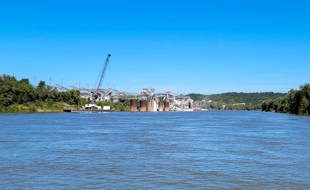
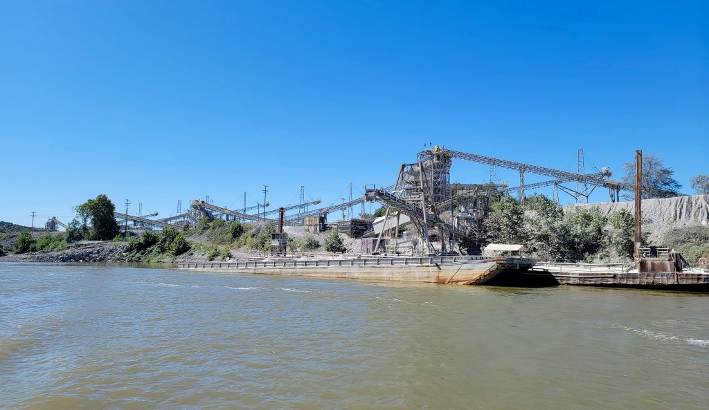
We had an uneventful passage to Green Turtle Bay, except that the current was even stronger against us on the Cumberland River. At one point we could see the current push a red marker right under the water. Even when it bobbed up again only the top third was visible. We ran fast for part of the day to make up some time. We passed several huge quarries on the journey, an enormous scar on the landscape. The first, and largest, was purchased in 1903 by Barrett & Son. The company was based in Cincinnati and ran barges on the rivers. At the time, the quarry extended for a mile along the bank of the Cumberland River. Today the quarry is operated by LaFarge Aggregates. As we passed, we could see a barge being loaded with sand. The loading is done from one end, and you can see in the photo that the stern of the barge is only a few feet above the water, while the bow is still very high. The sheer weight of materials that these barges hold is incredible, and then to think that they are attached together in strings of 12, 18, even 24 barges, all pushed by a single tow.


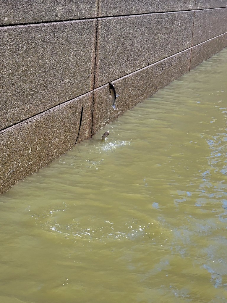
Barkley Lock is a 57-foot lift into Lake Barkley. As we made our way in, we could see that the port side was roiled by jumping 3- and 4-foot silver carp. Unfortunately, we had already committed to tying that side! It proved impossible to snap a picture that captures the sheer number of jumping fish, but you can see how big they are and how high they jump. Some jumped under Nine Lives, hitting the tunnel between the hulls with a loud crack! Fortunately, none ended up on board (or worse, in the dinghy). We have heard from others that if they get on board, it is a heck of a mess to clean up, because they bleed all over as well as depositing large amounts of slime.
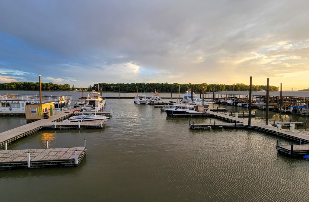
Green Turtle Bay is a large resort and marina on Lake Barkley. Many Loopers stop there, often for a few days or even weeks. It is a very pleasant resting stop after a fairly gruelling trip down the rivers. We only stayed one night, expecting to be back several times in future. We walked up to the tavern, and enjoyed the evening.

The passage to Paris Landing State Park was straightforward. The docks were nearly empty, but we were delighted to catch up with fellow Loopers on Island Girl, who we first met in 2018. We could see from our Nebo app that there was a very large pack of Looper boats making their way south. With limited transient slips available this year, and the concerns about our anchor winch, it was better to stay ahead of the group.
As we headed south on Kentucky Lake, it was a little confusing. We were actually up-bound, as the lake/river system is flowing north at that point. Dick had to remember which direction we were travelling when calling the tows.
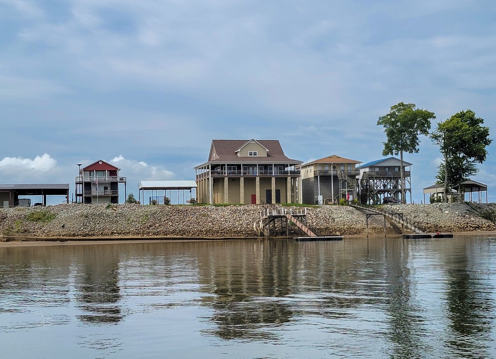
Kentucky Lake is a reservoir created by the construction of Kentucky Dam in 1938 to 1944. The reservoir drains the entire Tennessee Valley watershed, which covers an area of 40,200 square miles. It is part of the Tennessee Valley Authority, helping reduce flooding on ten million acres of the lower Ohio and Mississippi rivers. The top of the gates on Kentucky Dam are at 375 feet above sea level. The TVA requires that all permanent structures be built at 381 feet above sea level. This results in what we thought were very strange looking houses and cabins on enormous stilts along the waterway. The lake is long and narrow, and for much of its length it appears to be more like a river, and has a fairly strong current. Where it widens, it tends to be very shallow, as we discovered when we tried to follow a more scenic route closer to the western shoreline!
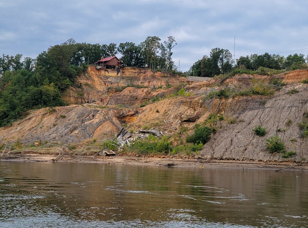
Although the lake may help with flood control, erosion can still cause problems where the banks are sand instead of shale or other rock. We passed one area where there was evidence of land slips, and at one point we could see a house perched precariously on the edge of the hillside, with debris at the bottom where another house had been completely destroyed. In spite of the obvious danger, it appears that the house at the top is still occupied. We could also see places along the water where the limestone banks had been undermined by the flowing water. Some quite substantial houses were built above, and we thought that the owners might not have chosen to built there if they had seen the site from the water!
We stopped next at Cuba Landing, and enjoyed dinner on Nine Lives with Ken and Karen from Island Girl. I tried a new recipe for the pressure cooker, a sausage and bean cassoulet. Another keeper! We traded stories of people we had met and places we had been on the loop since our last meeting.
The run to Clifton was pretty, with the leaves just beginning to turn, and bald cypresses looking picturesque in the afternoon light. There was a lot to look at, mostly cottages and homes along the river, rather than the industry we had been seeing since Chicago. Clifton was not the most salubrious marina, with many small biting insects, especially after dusk, and the restaurant is outdoors. The food was rather strange, but we had a lovely evening in company with Loopers from California who were only 5 days from their start. Unfortunately, those small biting insects thought that Dick was dinner, and by the end of the evening his legs were covered in bites.
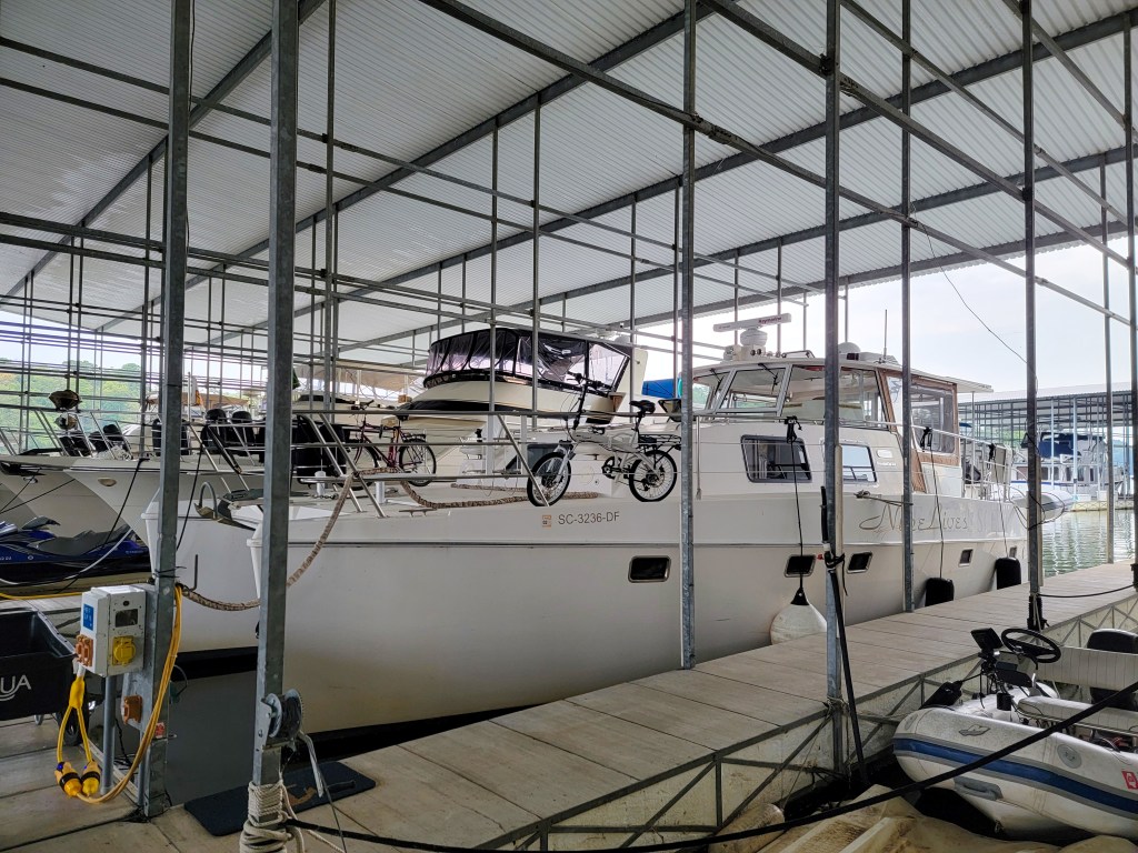
It was another easy trip from Clifton to Aqua Yacht at Iuka. Dick phoned Pickwick lock when we were an hour away to get a sense of how long we might have to wait. The lockmaster said that if we could get there within half an hour, we would go straight through with the boat that had been waiting two and a half hours, otherwise we would have to wait several hours for a big tow to lock through. Dick radioed Island Girl and asked, “do you have another gear?”. They did, and our two boats took off and made it with time to spare. We were tied up in our covered slip at Aqua Yacht on Pickwick Lake in Iuka, Mississippi by 2:30pm.
First though, we had to find the slip! Then, once we were in, we discovered that we had no mobile signal whatsoever, and no way to contact the marina to ask for the wi-fi code. Fortunately, the owner of the slip, who we are renting from for the next 3 winters, showed up very soon after we arrived and was able to give us the information we needed.
The next morning, we had Nine Lives hauled out to check the situation with the sponsons. We suspected that they were filled with water again, as happened the last two seasons. I have never been on the boat when it was being lifted by a travel lift before, not really an experience I wish to repeat. Once we were at grade level, we had to climb off over the bow pulpit. I declined the privilege of returning the same way, and chose instead to walk over to the fuel dock to meet Dick and the dockhands.

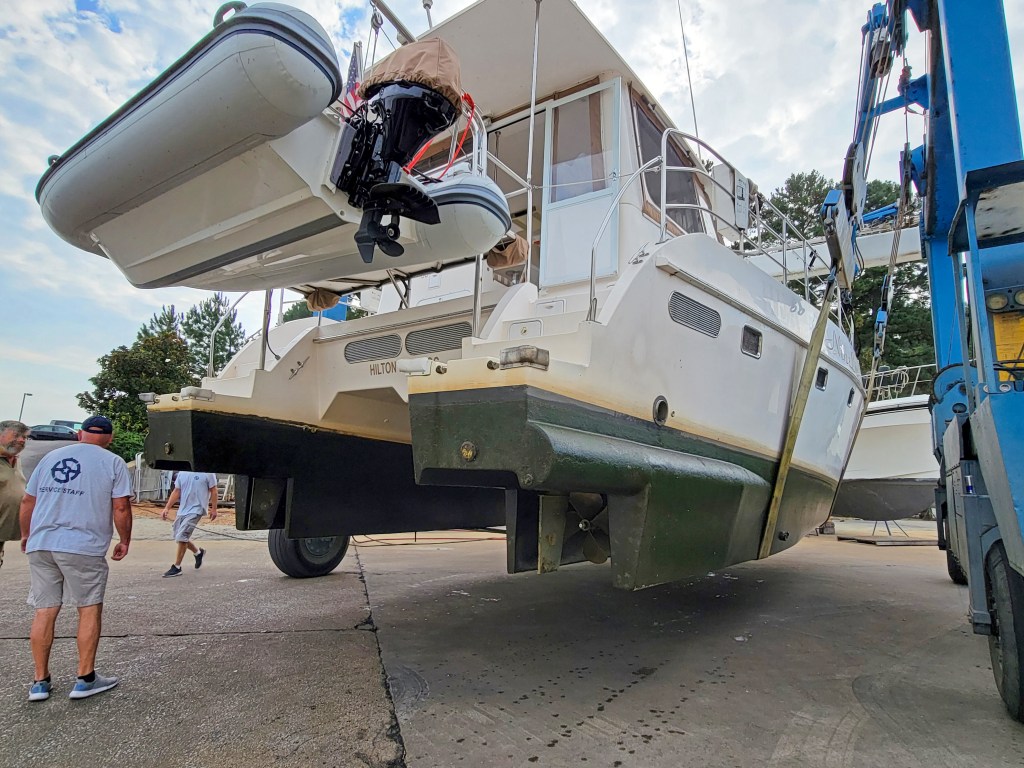
We were very surprised and pleased to find that the sponsons did not have any water in them. Also, the props are in excellent shape. The tech was very impressed that they were not dinged. Good driving on Dick’s part!
We had dinner at Aqua Grille, the onsite restaurant. The food was very good pub food, but they do not serve wine, only beer and mixed drinks!
After a day and a half of sorting, organizing, packing, and cleaning, we were ready to head out on Sunday morning. Nine Lives will snooze until next June in her covered slip, in the water for the first winter in some years. Dick will be back to check on her and will take a couple of small space heaters to keep the engine room warm in case of freezing temperatures. He will also drain the water system. We took off all cans and jars this year, again, in case of freezing weather.
We stopped overnight outside Atlanta, and were happy to arrive home in Hilton Head by noon. This concludes the Nine Lives 2021 voyages. We travelled 2112.5 miles, underway for a total of 244.1 hours. We passed through 13 locks. We spent time in 7 states, and our journey took 119 days.
The story will resume some time in June of 2022.

Fabulous final chronicle of your 2021 journey!
Thank you for sharing.
LikeLike
Thank you, Dick. Good to see you and your wife in on the water again.
Regards, David Lim
LikeLike